The first town(s) in Mass (North Adams/Williamstown...both within 2 miles of each other), however, were definitely a nice places despite not having too many accommodations for hikers. The local Howard Johnson does have a hiker rate, though, so I definitely took full advantage of that. Plus it was great to get away from staying at a typical hiker hostel...while they are fun, it's extremely difficult to get sufficiently clean at them.

The trail coming in to North Adams. That's right folks, the same footpath that leads to the wondrous white mountains of New Hampshire and the pristine wilderness of Maine also happens to go down some guy's driveway in Massachusetts.
And then it was on to Mount Greylock, the tallest mountain in Massachusetts. At 3,491 feet, it is a far cry from the taller mountains I had scaled previously, but one of the taller ones I had encountered in a while.
And true to form, Mt. Greylock is in full accordance with the Mount Washington's Law, which states that if a given mountain is the tallest one in a specific state, then that mountain must have something tacky on its summit (with the exception of Maine because Maine has laws protecting the summits of its mountains from tacky things). See photo below:

Apparently, it's a war memorial honoring Massachusetts' fallen heroes. You can go inside it and climb to the top, but i skipped that because the weather was so foggy I wouldn't have been able to see anything at the top.

Yep. Right there is where the really sweet view is supposed to be.
It wasn't all bad, though. An 80% chance of rain had been predicted that day, yet I hiked all day and managed to skirt the storm. Talk about lucky! And what made it better was that I had decided to hike from one town (North Adams) to another (Dalton) in one day, but because of the impending threat of rain I quickened my pace and ended up finishing the 23-ish miles in the early afternoon. The hostel in Dalton was alright, and it was definitely nice to get a shower 2 days in a row.

A plaque at the hostel. You typically see these hanging in people's houses that say things like "forgive the mess" and whatnot, but this one had a slightly different tune. I like it, but don't ask me why...
The Blueberry Side Quest:
Not as dramatic as the Rutland escapade, but it has a very Zelda-esque feel to it.
Right by the trail, there is a blueberry farm:


This farm is owned by a woman whom is referred to as simply "the cookie lady" and her husband Roy. She is called the cookie lady because she gives out free cookies to thru hikers (they are delicious).
Also of note on the farm is Roy's full sized aircraft hanger, complete with plane and small runway.


Yet here, Southbound thru hikers are allowed a special privilege; we are permitted to pick blueberries for free, but only if we promise to take them 10 miles further south to a mountain cabin near the trail. I agreed, and filled my bottle with blueberries.

10 miles later, I arrived at Upper Goose Pond Cabin. What once was a private vacation cabin is now a fully functional (and free!) AT destination, complete with full time care takers, bunks with mattresses, and plenty of room for tenting nearby.

You could also take a boat out on the lake if you so desired. I got there a bit late in the day, though, so I opted to hang out and watch the sun set instead:

The next morning, I finally realized what the blueberries were for:

The cabin caretakers make hikers fresh pancakes in the morning. The blueberries are added in. Needless to say, I became very popular very quickly.
And it wouldn't be a trip through Massachusetts without some American History. The trail goes literally right by this monument:
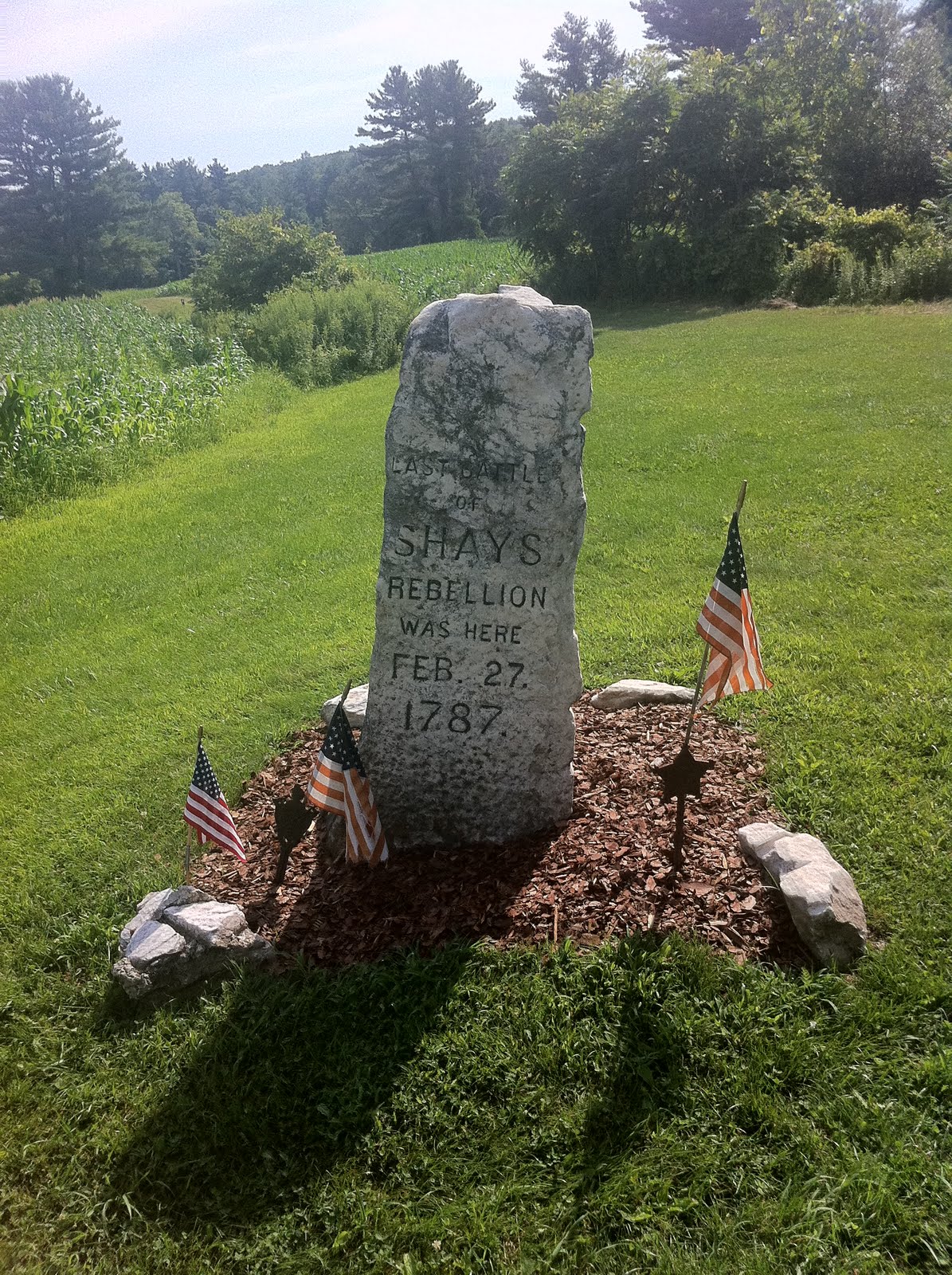
For those wondering what what Shay's rebellion was, see details here. It was definitely a fairly important post-revolutionary war event, and I had no idea the trail would take me there. I'm glad it did, though.
The weather got better too. I did get to see a nice view before I left.

And now I'm in Connecticut, but honestly not for long...it's a really short state as far as the trail goes.

The handwritten commentary on the sign is accurate...the sign itself is indeed pointless considering it's about a mile from the actual border.
But I do appreciate the fact that I knocked out the tallest mountain in the state the first half hour I was in it. And sure enough, a tacky monument was at the summit:


The inscription reads: This monument marks the highest ground in Connecticut 2391 feet above the sea. Built in 1885. Owen Travis. Mason.
A bit unnecessary, yet much less tacky than Mt. Wash/Mt. Greylock, all things considered.
New York is at most two days away. I can't wait to get out of New England...
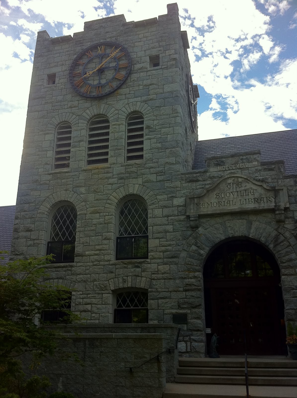
Oh, and a side note, this blog update was written in a public library that claims to be the oldest one in the country:

Oh Appalachian Trail. How random the places you take me are.
That Prolink project finally went into production on August 1. I'm sure you are bummed that you missed that! Keep up the great work. I enjoy reading your blog.
ReplyDeleteI'm so jealous... I wanna go blueberry picking :(
ReplyDelete23 miles in one day? Wow! Well done. I'm embarrassed - my best was 67 miles on my bike. Brit guy you met in laundromat.
ReplyDelete